Introduction
The Agreement for Shared Stewardship (August 2020) between the State of California and the USDA Forest Service Pacific Southwest Region emphasizes two key actions by 2025: treat one million acres per year and develop/implement it via a joint plan. The "million-acre" plan will prioritize community safety and ecological restoration and it will be developed in collaboration with all stakeholders. Significant progress has been made toward preparing for substantive actions that will realize these ambitious goals. The State of California has issued a new Wildfire and Forest Resilience Action Plan that is designed to strategically accelerate efforts to restore the health and resilience of California forests through a joint State-Forest Service framework to enhance stewardship in California. We have both the social incentives and the scientific knowledge to pursue meaningful restoration of forested landscapes in California. An essential component of these initiatives are the data that can a) enable through and rapid evaluation of landscape and b) support expansion of restoration projects to a larger spatial scale. Access to high-resolution remote sensing and GIS data sources, experiences with landscape restoration assessment and modeling efforts, and advancements in high-performance computing capabilities now enable land managers to take steps to work effectively at a landscape scale throughout California.Basic Principles of Regional Resource Kits
The Regional Resource Kits have adopted the “Framework for Resilience” to provide a structure for assessing landscape conditions, setting objectives, designing projects, and measuring progress towards social-ecological resilience. There are ten pillars that represent the desired outcomes of landscape resilience. Each of the pillars provide a series of metrics for assessing landscape conditions and verifying that actions meet resilience objectives. Metrics describe the characteristics of elements in quantitative or qualitative terms. Users can use metrics to assess, plan for, measure, and monitor progress towards desired outcomes and greater resilience.
What are in the Regional Resource Kits?
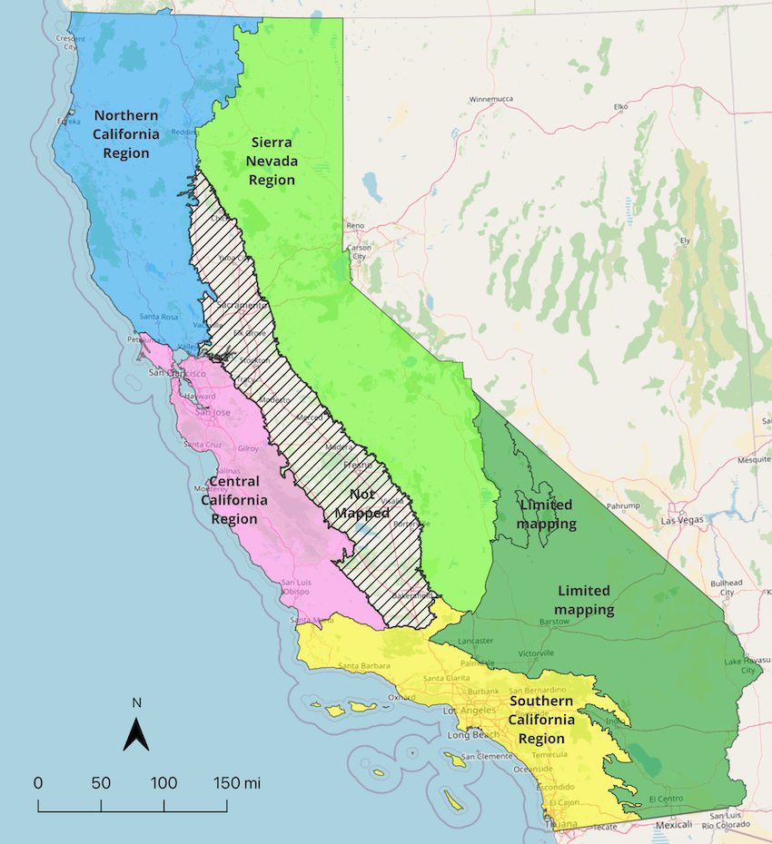
Regional Resource Kits (RRK) are sets of data created to accelerate the work by regional partners and collaboratives to reduce wildfire hazard and improve the conditions of forested and shrub landscapes. The kits include, among other elements, a database of management-relevant metrics that have been vetted by federal, state, and academic scientists and spatially explicit assessments of current conditions for key resources in the region. The Resource Kit will be revised based on user feedback and updated as new science and technologies are developed. The data in the kits can be used with a conventional GIS and/or with specialized Decision Support Tools created to analyze spatial data. There will be a Regional Resource Kit for each of the four major regions in California. Each Kit will include:- A core set of metrics used to quantify each of the 10 Pillars statewide (Tier 1 metrics)
- An additional set of metrics that are relevant to conditions specifically within that region (Tier 2 metrics)
- A package of maps and data that characterize current conditions and desired conditions within the region
- A metric dictionary which defines each metric in detail, and the necessary metadata.
How will this information be useful to land managers?
- Landscape condition assessment
- Landscape planning at a range of scales
- Project (on-the-ground) planning, NEPA preparation
- Forest Planning analysis tools to evaluate management alternatives
- Quantification of costs and benefits for planned projects to stimulate funding investments
- Evaluation of restoration progress
- Working collaboratively across land ownerships
- Reduced wildfire risk and threats
- Mitigated climate change
- Enhanced water security
- Enhanced biodiversity conservation